[Date Prev][Date Next][Thread Prev][Thread Next][Date Index][Thread Index]
Re: El Paso Fireball Detection by DoD Satellite
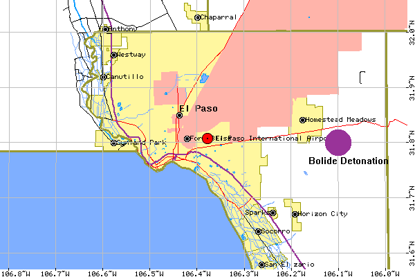
Here is a map of the area and the point of detonation according to the DOD press
release.

GeoZay@aol.com wrote:

> Below information I got off Peter's website that pertains to the Oct 9
> fireball near El Paso Texas.
> George Zay
> --------------
> >>Fireball Detection
>
> On 9 October 1997,  sensors aboard DOD satellites detected the impact of a
> meteoroid at 18:47:15 UTC near El Paso, Texas.
> The object detonated at an altitude of 36 km at 31.8 degrees North Latitude,
>  106.1 degrees West Longitude.
> **************************************************************************
> PLEASE NOTE THAT THIS SATELLITE BOLIDE RELEASE AND ALL PREVIOUS
> SUCH RELEASES CAN BE FOUND ON THE WWW AT
> http://phobos.astro.uwo.ca/~pbrown/usaf.html
> <<
References: